Skip to Content
Custom software for work in the field, since 2011
GPS · GIS · BIM

Custom software for GPS surveying and recording

Apglos builds custom software for people who work outdoors. With GPS and precise positioning, your crew records what happens on site: surveying, recording and checking, to the centimetre. That geodata flows straight into your GIS, BIM or any other file format you need, so the geoinformation in the office is always right.

Our own software since 2011 100,000+ users worldwide Active in 10+ countries
What it delivers
Save timeSurvey and record in one step. No retyping and no duplicate work.
Work more efficientlyYour crew works with one custom app. The geodata is in the office straight away.
Improve qualityCentimetre-accurate positioning and fixed input fields, so the data is complete and correct.
Reduce failure costsFewer errors, less damage and rework, because everyone works with the same up-to-date data.
Van Gelder GroupGelanJos ScholmanGeneral LaserNestleUnsalVandervalk+degrootGeoReality

From challenges in the field to smart positioning software

Every project follows the same four steps. Together we discover where things get stuck in the field, design the workflow, develop the software on our own platform and deliver the roll-out in your organisation.

Step 1
Discover
Intake and field analysis with your site staff. We map the current workflow, the bottlenecks and the data you need.Outcome: a clear overview of requirements and goals.
Step 2
Design
We turn the analysis into a functional design: input fields, roles and rights, GIS or BIM integrations and the export format.Outcome: design and planning for approval.
Step 3
Develop
We build the solution on our proven platform in short, clear phases. A first version is tested with your crew in practice.Outcome: a tested, working app.
Step 4
Deliver
Phased roll-out, training of your staff and go-live of the integrations. After that we take care of maintenance, updates and support.Outcome: a workflow that runs for the long term.
Ready for the next step?
Schedule a no-obligation intake. In one conversation we decide together whether and how your field workflow can be smarter.
Experience
15+ years
Users
100,000+
Rebrands
25+
Countries
10+

Positioning software in action

Infrastructure · Jos Scholman
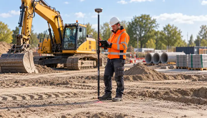
One portal for the green and grey divisions
Foremen record on site what happens. Per project, Scholman sets who can see and edit what.
Photo: a worker measures a point on a construction site with a GPS receiver and tablet, with an excavator in the background
Logo Jos Scholman
White label · Gelan
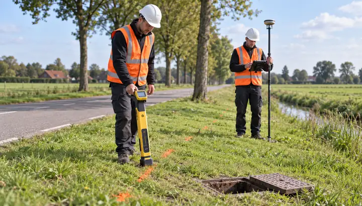
Detect and survey cables in one app
For Gelan we built Gelan GPS: our survey software under their brand, linked to the C.Scope cable locator.
Photo: a worker traces a cable in the verge with a cable locator while a colleague surveys its position with GPS
Logo Gelan
Rail · Van Gelder
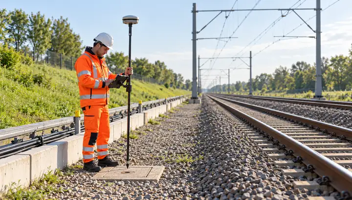
Setting-out app for the railway
The VGR Maatvoeringsapp records cables and pipes along the track according to ProRail’s requirements for as-built work and reporting.
Photo: a worker surveys an inspection pit beside the railway with GPS, next to the cable trough
Logo Van Gelder
Grid operators
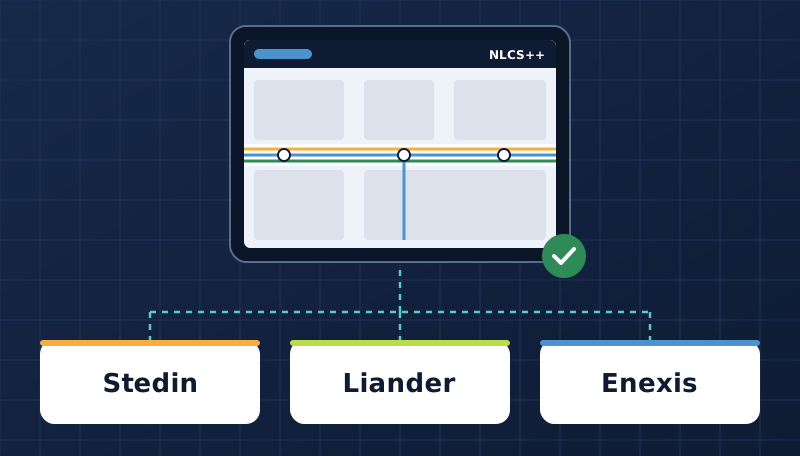
As-built records in NLCS++ for Stedin, Liander and Enexis
The ANR app records cables and pipes in the trench and checks the mandatory fields before handover.
Illustration: an NLCS++ as-built drawing on a tablet, delivered to Stedin, Liander and Enexis
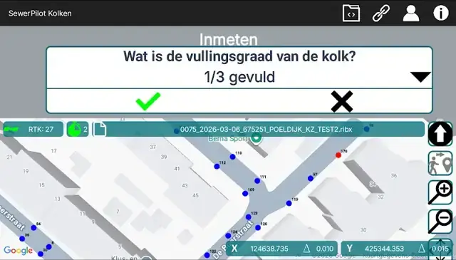
Sewerage
Recording gullies while cleaning
Sewer Pilot records every gully with position and condition, on foot with the pole or from the gully sucker.
Sewer Pilot on a tablet: the fill-level question for the gully, with the surveyed gullies on the map
No-obligation consultation
Find out where your field work can improve
Together we look at your current workflow and show where time, errors and duplicate work can be saved. You get honest advice straight away.

What it delivers

Save time

Your team measures the position and enters the data in the same place. No notebook, no matching photos afterwards and no retyping in the office.

  • No duplicate entry
  • No waiting for a surveyor
  • Data available straight away

Work more efficiently

The geodata lands straight in your system, in the format you need: GIS, BIM, DXF or CSV. Project managers see progress without picking up the phone.

  • One app for the whole crew
  • Instant insight into progress
  • Integration with your own systems

Improve quality

Fixed pick lists and mandatory fields make sure every worker records the same way. Incomplete records are stopped in the field.

  • Consistent recording
  • Mandatory fields before saving
  • Photo and position for every point

Reduce failure costs

A wrong or incomplete record means going back to site, a rejected as-built or damage during the next excavation. Getting it right first time avoids those costs.

  • Fewer return visits
  • Fewer rejected as-builts
  • Less excavation damage thanks to correct locations
What customers say

Software field teams measure with every day

Working with Apglos saves us time and money, and it gives our people tools they can rely on.

Jos Scholman Jos Scholman
In summary

Custom software based on a proven framework, tailored to your workflow

Apglos combines a proven GPS platform with custom software. We build the app that fits your workflow, under your own brand if you wish, and maintain it in consultation with you.

Proven platform since 2011
Survey Wizard works with any GNSS receiver and has been running in the field for years.
Built for your process
Your own questionnaires, codes, rights and integrations with GIS, BIM or your asset system.
Under your own brand
White label for hardware manufacturers and partners, already applied more than 25 times.
One point of contact
Development, training, updates and support stay with Apglos.

Time for your custom positioning software

A first conversation is free of obligation. Often we can tell you straight away whether an existing solution fits, or what is needed.